
March heat wave: early melt-out
The West's snow drought deepens due to record-breaking temperatures

Adios, winter—we hardly knew thee.
After a historically dismal season for snow accumulation in the West, what little snowpack remains is set to dwindle amid a stunning March heat wave.
The forecast below, which depicts the departure from normal temperatures from today to Monday, shows why so many locations are expected to demolish records.
In eastern Utah and western Colorado, some locations will be close to 30 degrees above normal by week’s end, according to the NOAA weather radio I listen to in the shower.
Writing for CNN, Andrew Freedman describes the March heat wave this way:
Meteorologists are reaching for superlatives to describe an oncoming heat wave so intense and rare for this time of year that it could leave some locations shattering their all-time temperature records for April before that month has even begun.
This extreme event, made far worse by human-caused climate change, will bring summerlike temperatures during March to locations from California to Texas, northward all the way to Montana.
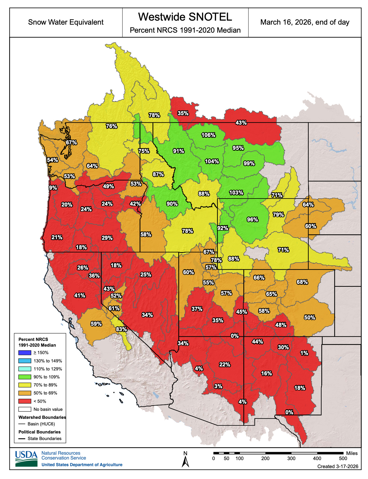
Heading into the heat wave, snowpack readings were bleak across much of the West, as shown in the March 16 map below.
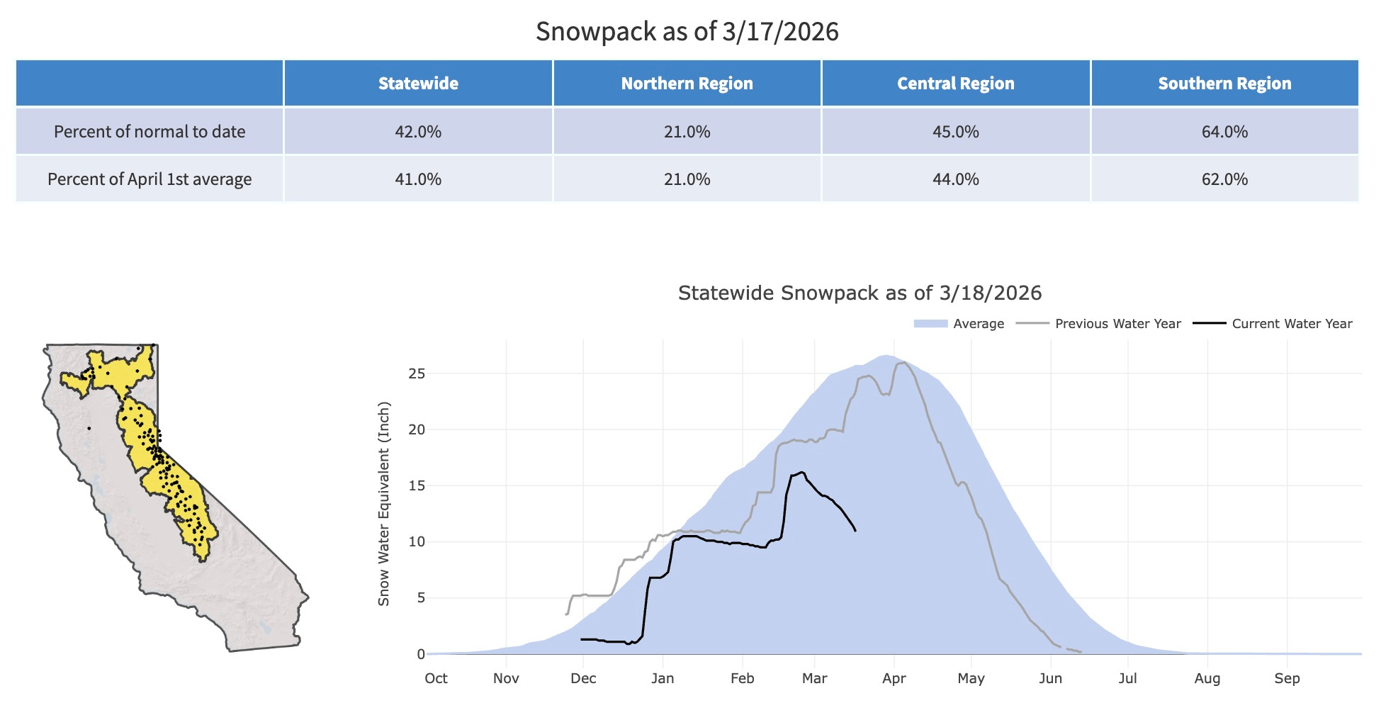
The decline of the Sierra Nevada snowpack has been staggering. In the chart below, the plunging black line traces a sharp drop over recent weeks, with statewide snowpack now at just 42% of normal—and only 21% in the northern region.
Snow drought intensifies
Even before the heat wave, the West’s snow drought had been deepening.
“Snow drought worsened from February into early March due to record warmth, despite near-normal precipitation across much of the West,” according to a March 12 update from the National Integrated Drought Information System. “Every major river basin in the West experienced its first or second warmest winter (December, January, and February) on record.”
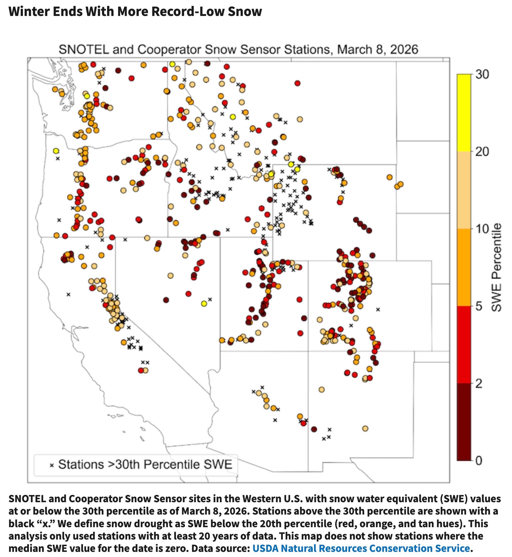
The map below shows snow water equivalent percentiles on March 8. This snow drought is both extreme and widespread, with stations across every Western state falling below the 30th percentile. All those dark red circles are at or below the 2nd percentile.
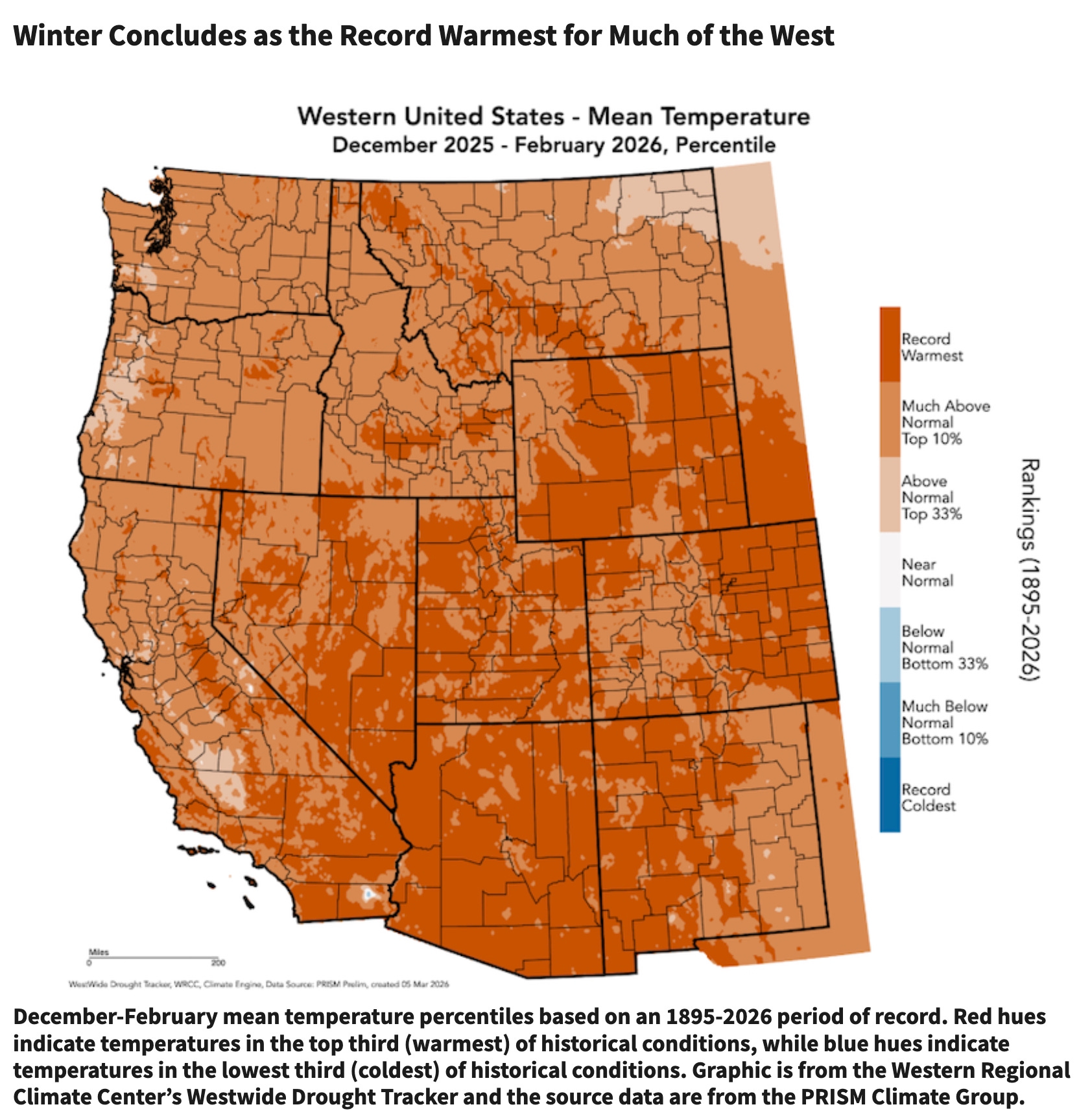
What’s most striking about this season is how strongly it has been shaped by high temperatures—a “warm” snow drought—rather than a lack of precipitation, or a “dry” snow drought.
While some parts of the West have been drier than average, even places with normal to above-normal precipitation have seen subpar snowpack because much of that moisture has fallen as rain. The map below shows that from December 2025 through February 2026, record-breaking heat affected much of the region.
“Worst-case weather scenario” for Vail Resorts
One way to quantify the severity of this season’s snow drought is through the financial performance of Vail Resorts (NYSE: MTN), a dominant player in the West’s snow sports industry.
On March 9, the company said it had experienced a “worst-case weather scenario,” noting that “season-to-date total skier visits were down 11.9% compared to the prior year period.”
“This has been the most challenging winter across the Rockies that we have ever experienced with the lowest snowfall levels in more than 30 years for our Colorado and Utah resorts, combined with warmer temperatures, resulting in reduced terrain throughout the quarter and into February,” CEO Rob Katz said.
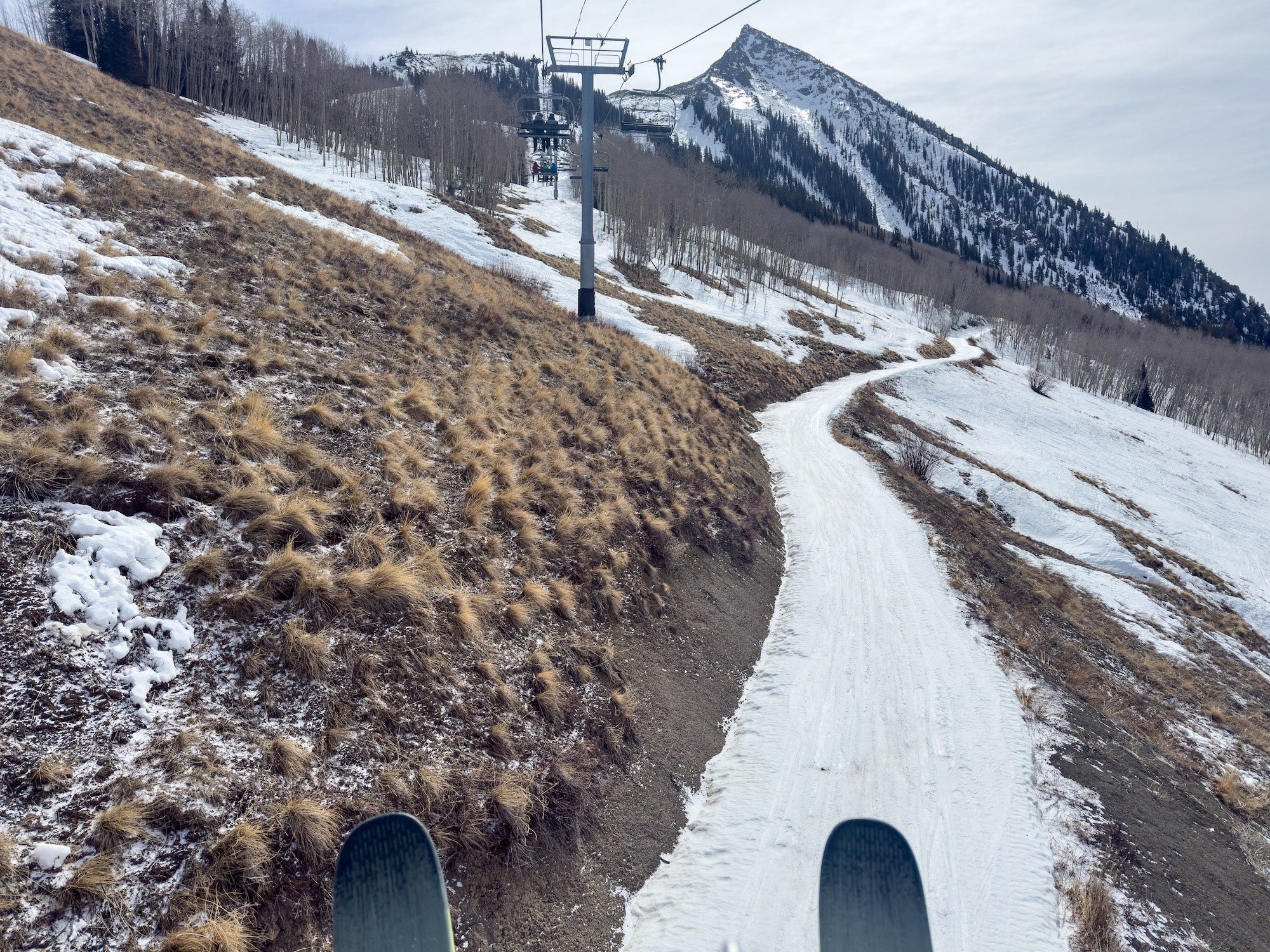
I’m on spring break this week, so I just got back from a couple of days of skiing, one of which featured sub-zero windchills at Crested Butte, a Vail Resorts property with threadbare snow cover.
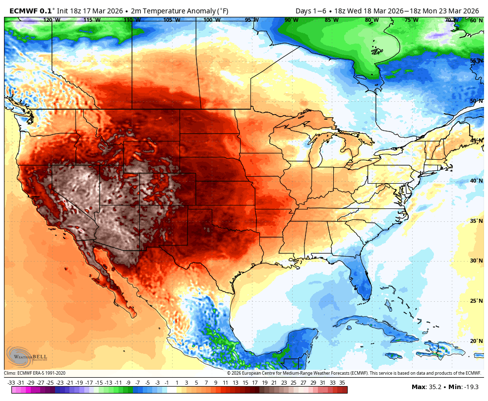
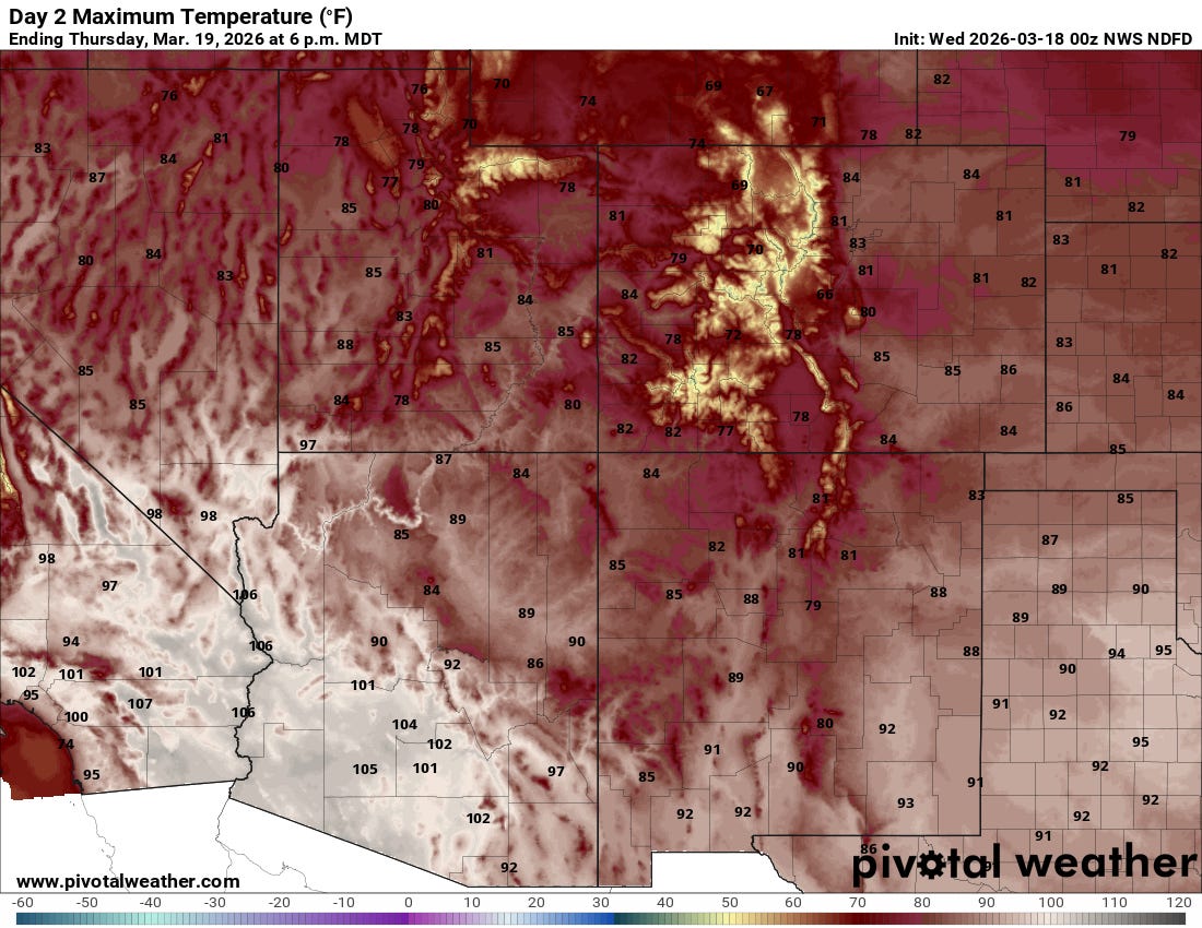
Now I’m packing a bathing suit and sandals for a trip to Sedona, Arizona, where the temperature will approach 100 degrees this week. Phoenix and Tucson will soar past the century mark in a winter that has shattered norms.
Below are the white-hot temperatures forecast for the Southwest tomorrow. On the last full day of winter, even the high country of the Rockies will be far above freezing while the deserts bake. You can even make out the Colorado River—a white, squiggly ribbon—through the Grand Canyon in northern Arizona.
Long-term projections for 21st-century precipitation can be all over the map, but the trend of rising temperatures is crystal clear. The warm snow drought we’re now experiencing is exactly what you’d expect more of as the climate heats up.
On Monday, a small wildfire started about five miles from my house near Durango. Crews now appear to have the one-acre blaze in check, but it’s foreboding to see a firefighting helicopter working in the middle of March and receive wildfire alerts on my Watch Duty app.
El Niño is looming
As winter closes out, it’s also time to say goodbye to La Niña and prepare for a likely El Niño.
The latest federal forecast on March 12 hoisted an El Niño Watch. The graphic below shows a high chance that this pattern (red bars) will take hold later this year.
This incarnation of El Niño looks to be a strong one, with some folks referring to it as a “Godzilla El Niño.”
Ben Noll of The Washington Post notes that the El Niño “could rival the strongest ones in history.”
These cyclical changes in sea-surface temperatures and atmospheric circulation in the tropical Pacific can have profound impacts on weather worldwide. Higher global temperatures are likely, as is less hurricane activity in the Atlantic. In the American West, El Niño tends to make the Southwest wetter and the Pacific Northwest drier than normal, but it’s by no means a sure thing.
Grim projection for Colorado River runoff
This season’s abysmal snowpack will have both local and far-reaching effects in the American West.
Inflows to Lake Powell on the Colorado River are projected to be paltry, adding even more pressure to the high-stakes, logjammed effort to devise new rules for the declining river.
Federal hydrologists are forecasting that Lake Powell will receive only 2.3 million acre-feet of water from April through July—just 36% of the 1991-2020 average. It looks like the worst year since 2002, a time I remember well because I spent months covering wildfires and eating smoke as a reporter for the Arizona Daily Star.
The chart below shows Powell’s projected elevation. The dotted horizontal line, at 3,490 feet, indicates “minimum power pool,” the level below which Glen Canyon Dam can’t pass water through its enormous turbines to generate hydropower. The green dashed line, which marks the “most probable” inflow to Powell, dips below the minimum power pool by the end of this year. The “probable minimum” inflow in red falls below it even sooner—this summer.
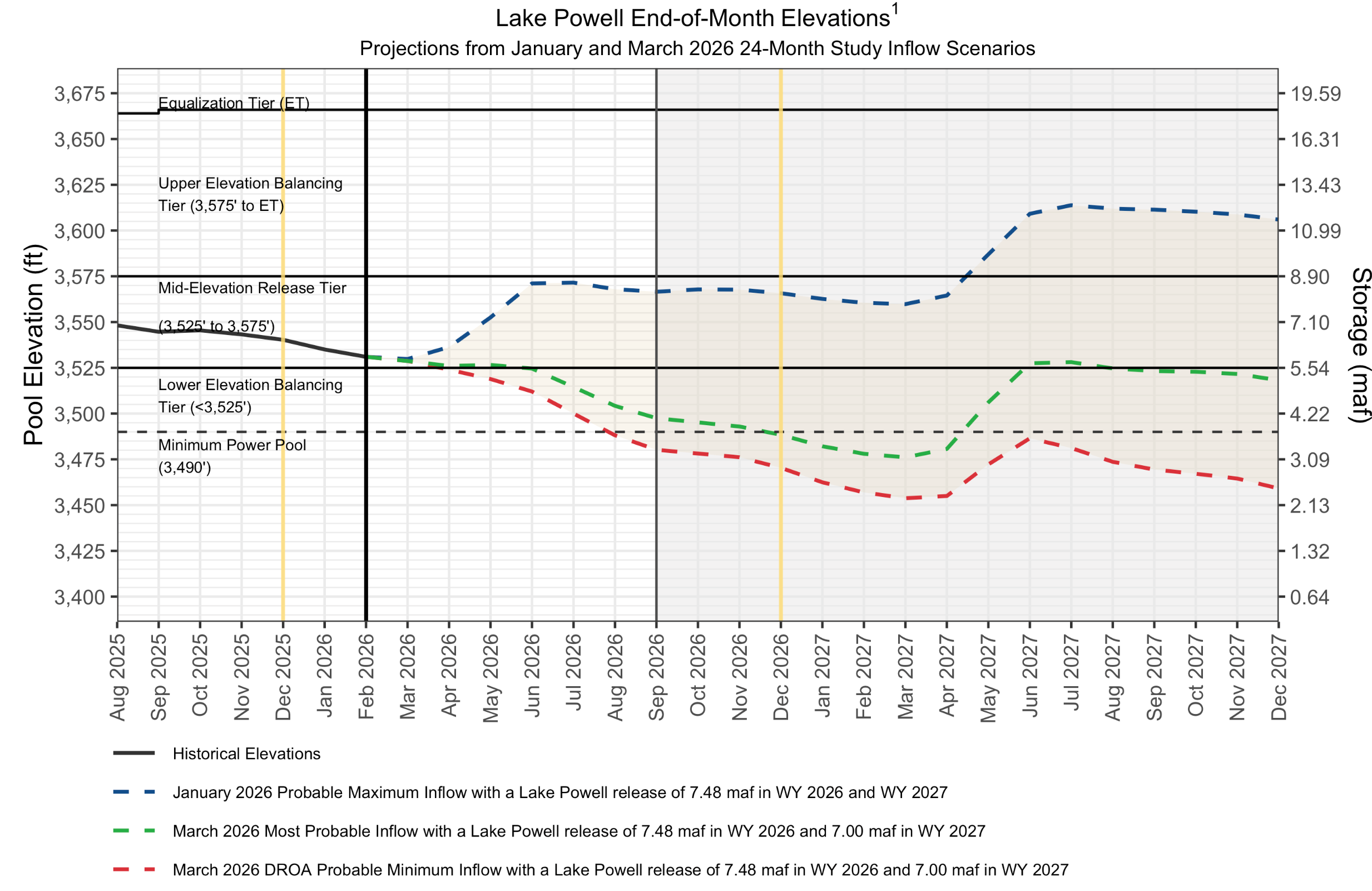
Powell is 25% full, and Mead is at 34% after more than two decades of warming-induced “megadrought.” These two metrics are like the Dow and S&P 500 for the Colorado River’s water supply. The bear market of the past quarter-century shows no signs of abating.
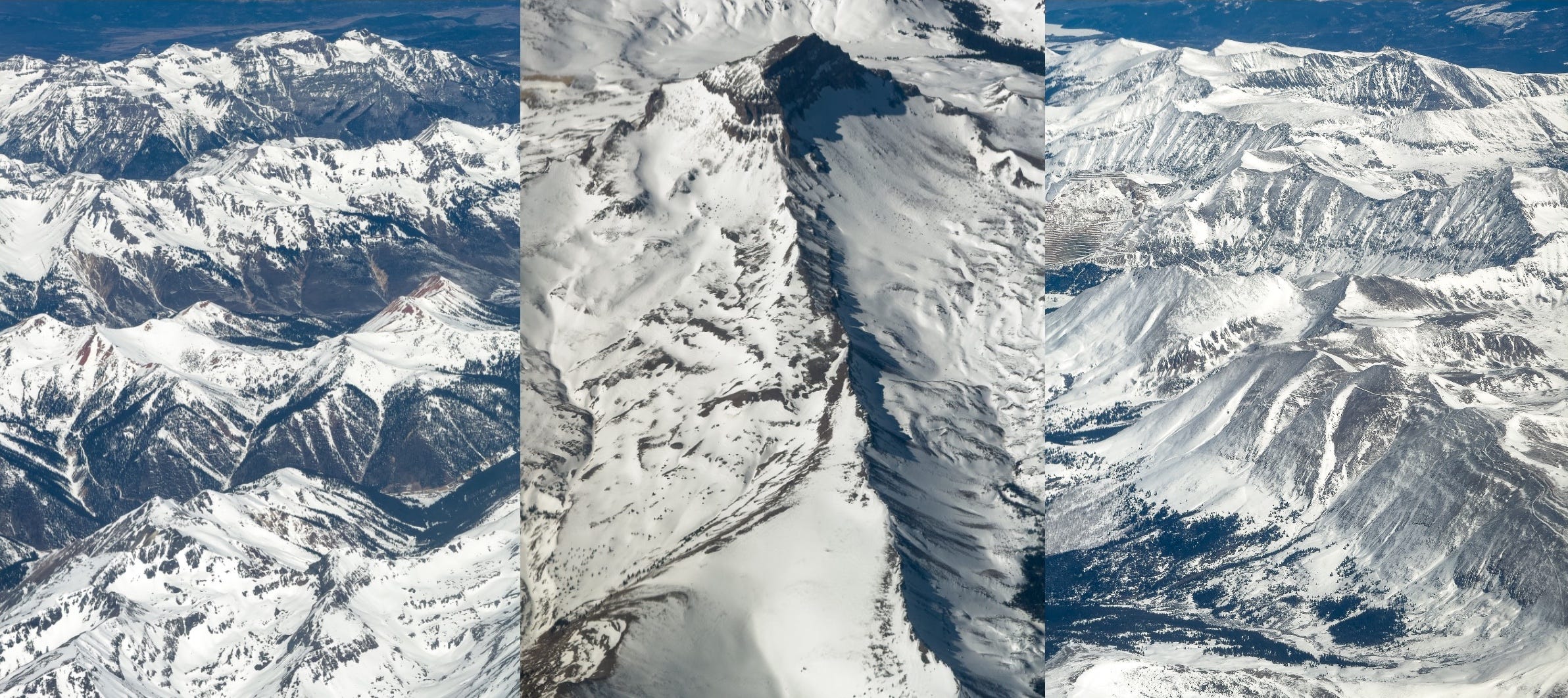
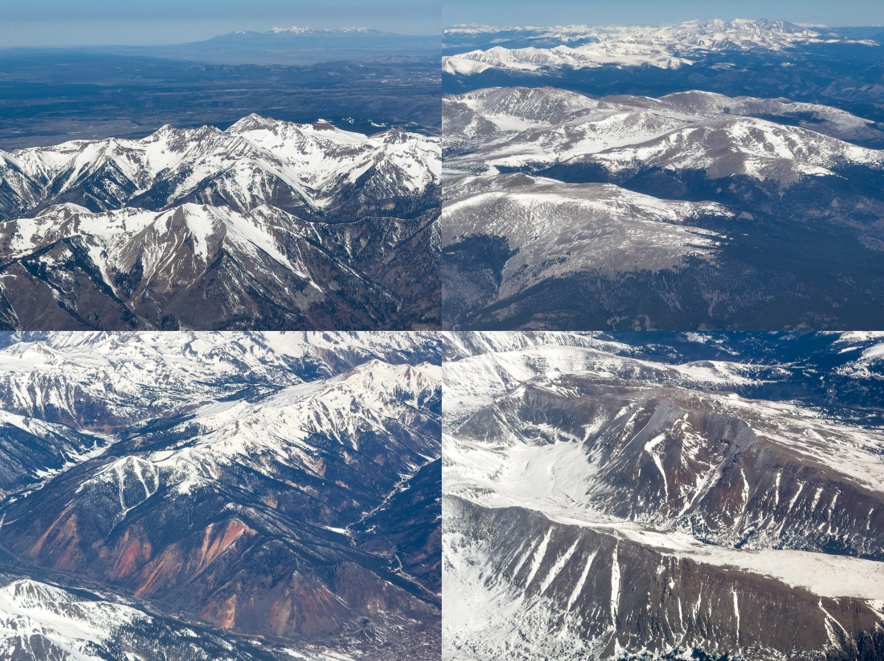
Durango ✈︎ Denver aerial photos
Before the heat wave, I took a quick work trip to Washington, D.C., offering me a chance to inspect Colorado’s troubled snowpack on a flight from Durango to Denver. It’s one of the most scenic 45-minute flights in the West in any season, assuming it’s not too cloudy.
In my previous post, I wrote about how snow can generate both joy and misery—often on the same day. One downside I didn’t cover was disruption to air travel, and the snow gods sure reminded me of that during my return on March 6, when Denver International Airport picked up 8.5 inches.
I somehow managed to perfectly time one of my rare visits to DIA this past year with the biggest snowstorm of the season.
We sat on the tarmac at Dulles for nearly two hours. My connection to Durango was cancelled. The last flight of the day to Durango was delayed by three hours, plus another hour as we waited for the plane—and then a flight attendant.
I spent nearly eight hours at DIA and made it home at 1 a.m., almost 18 hours after leaving the D.C. hotel.
It was all snow’s fault.
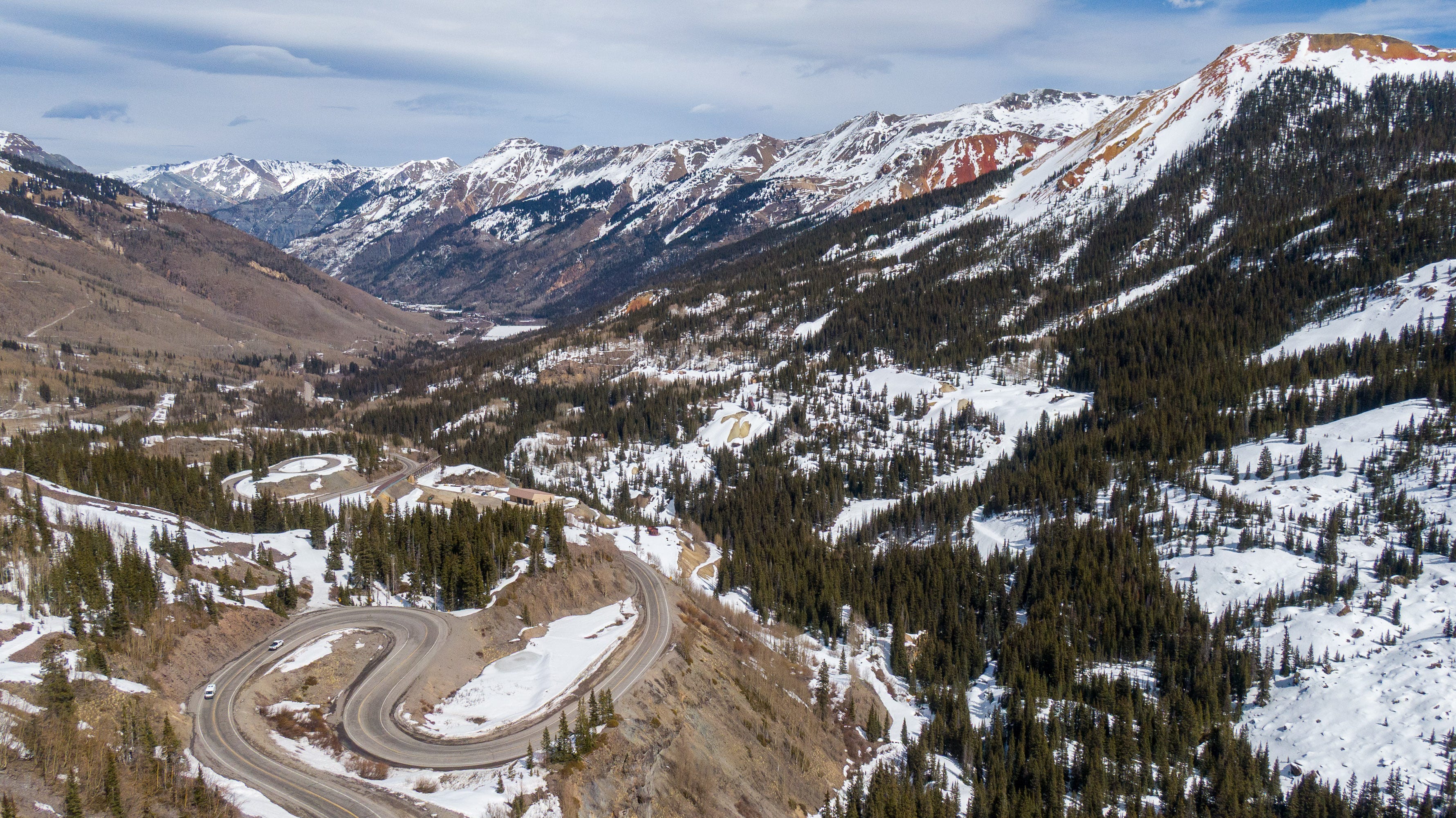
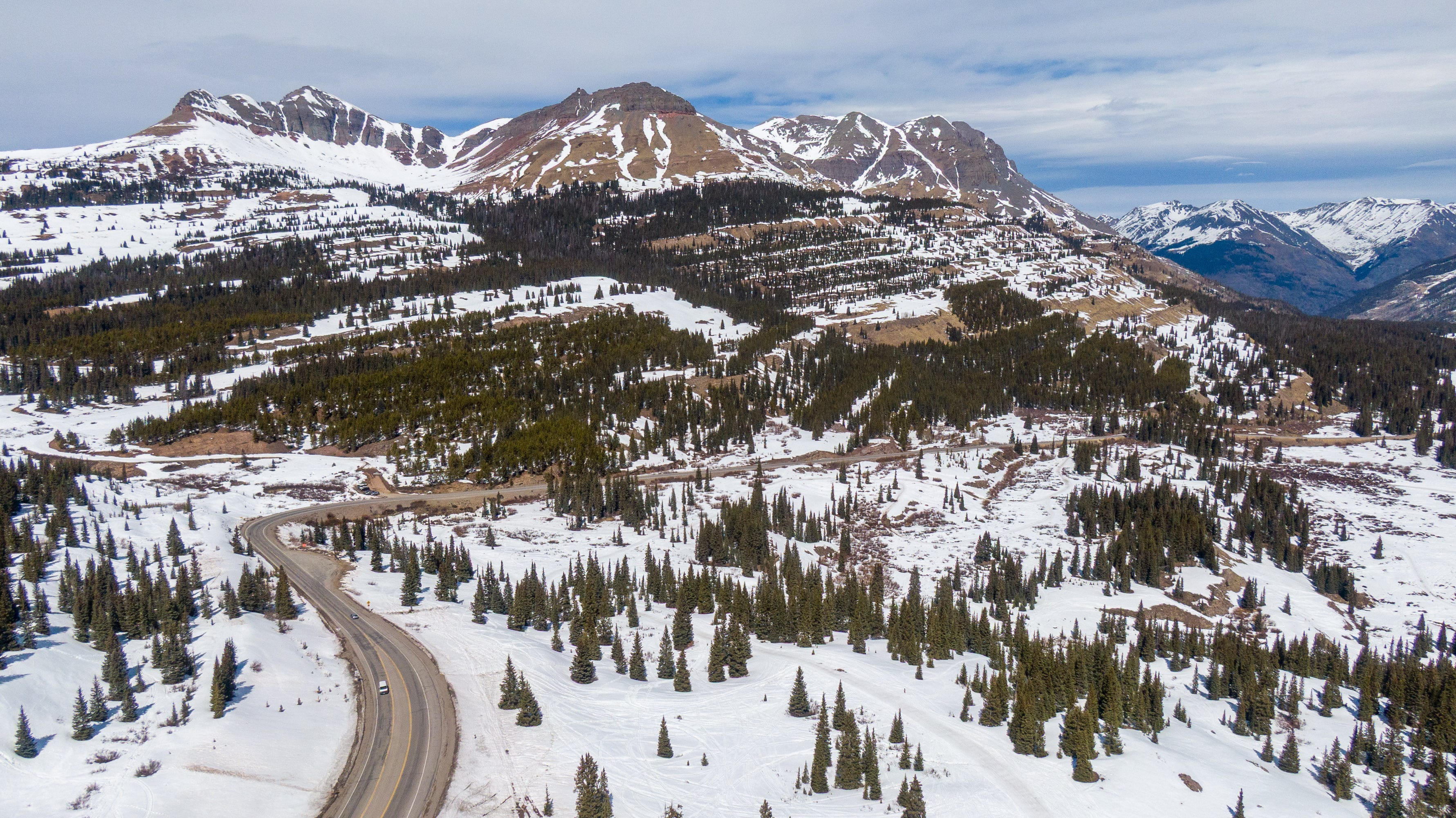
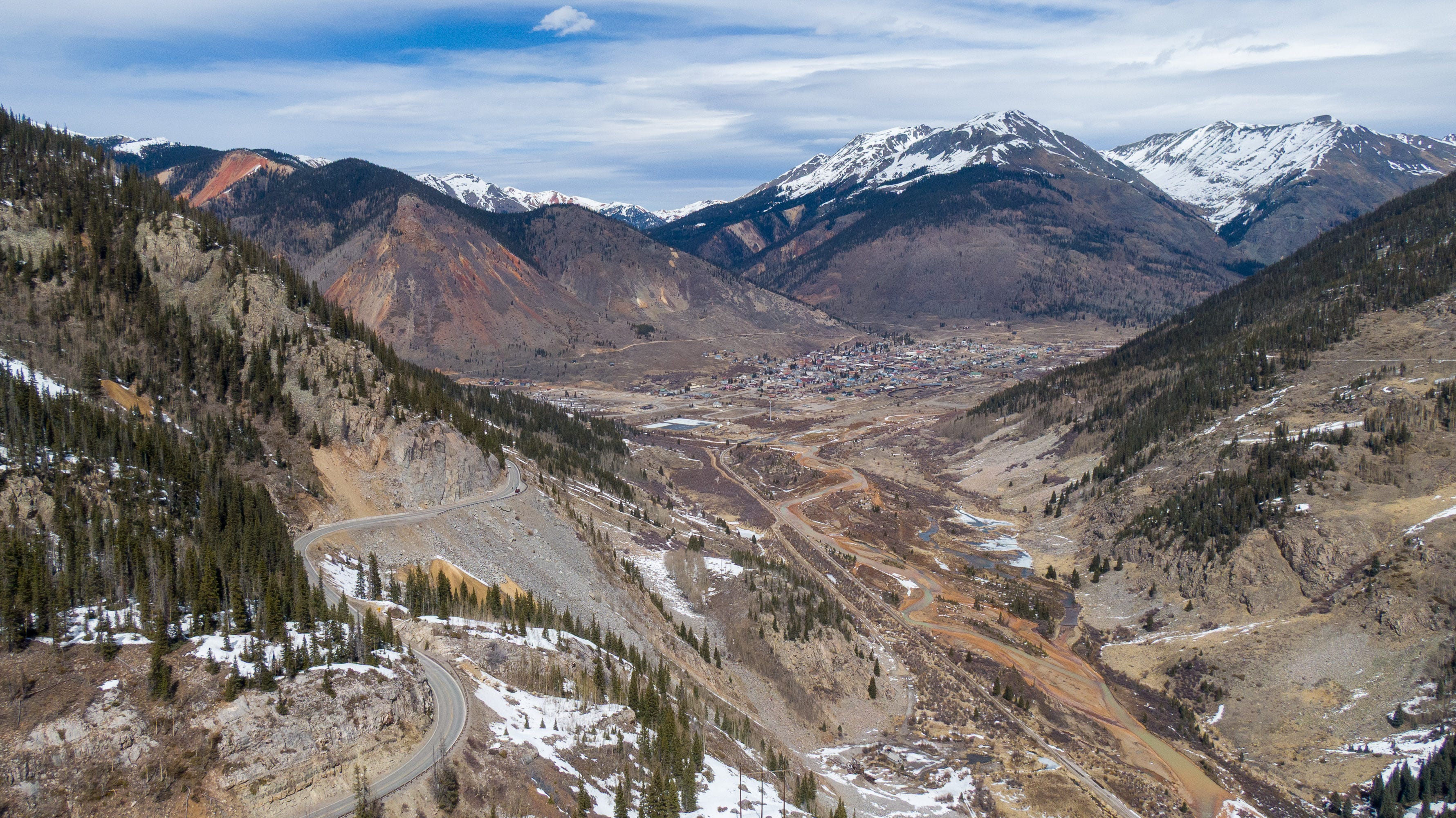
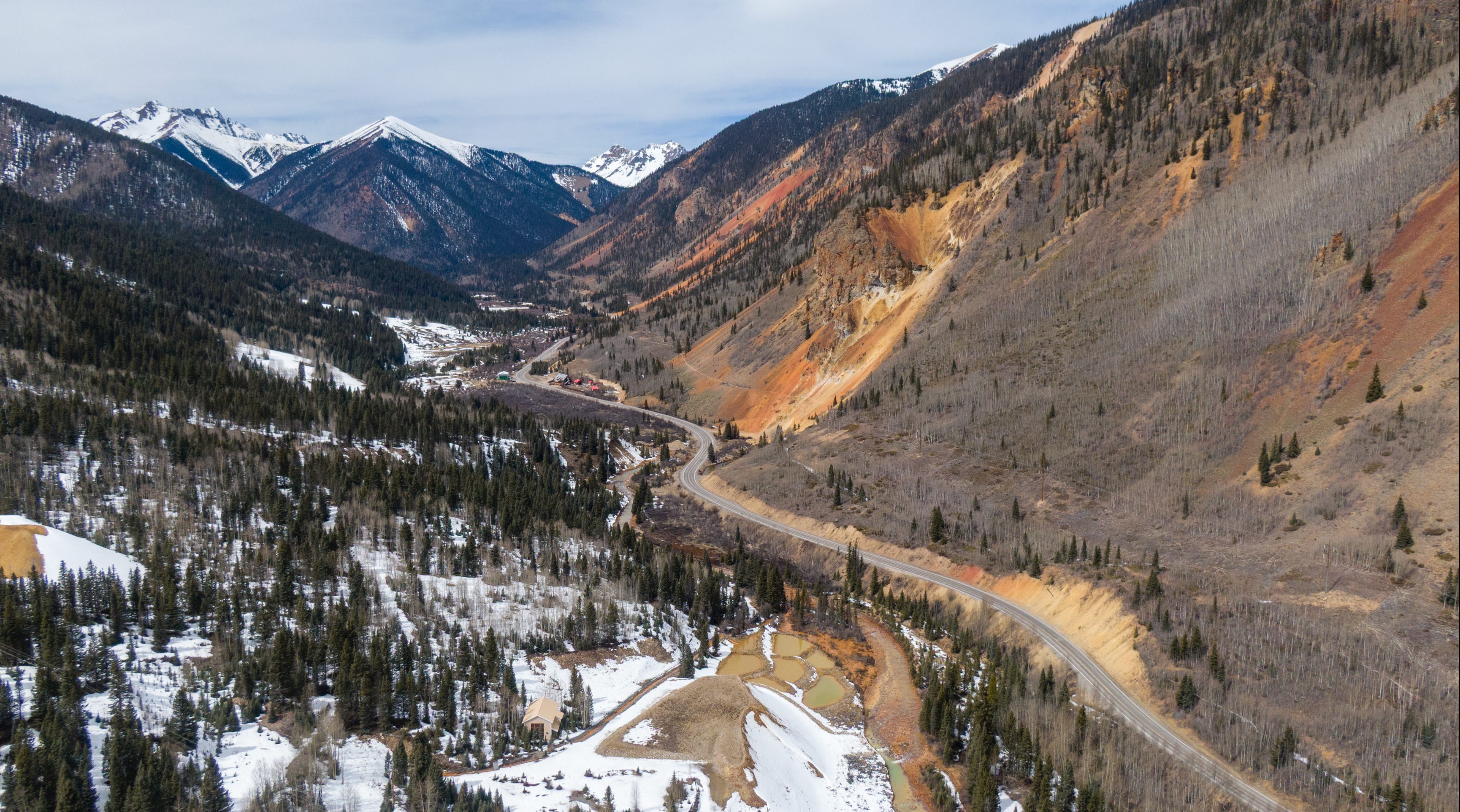
Drone images of Colorado mountain passes
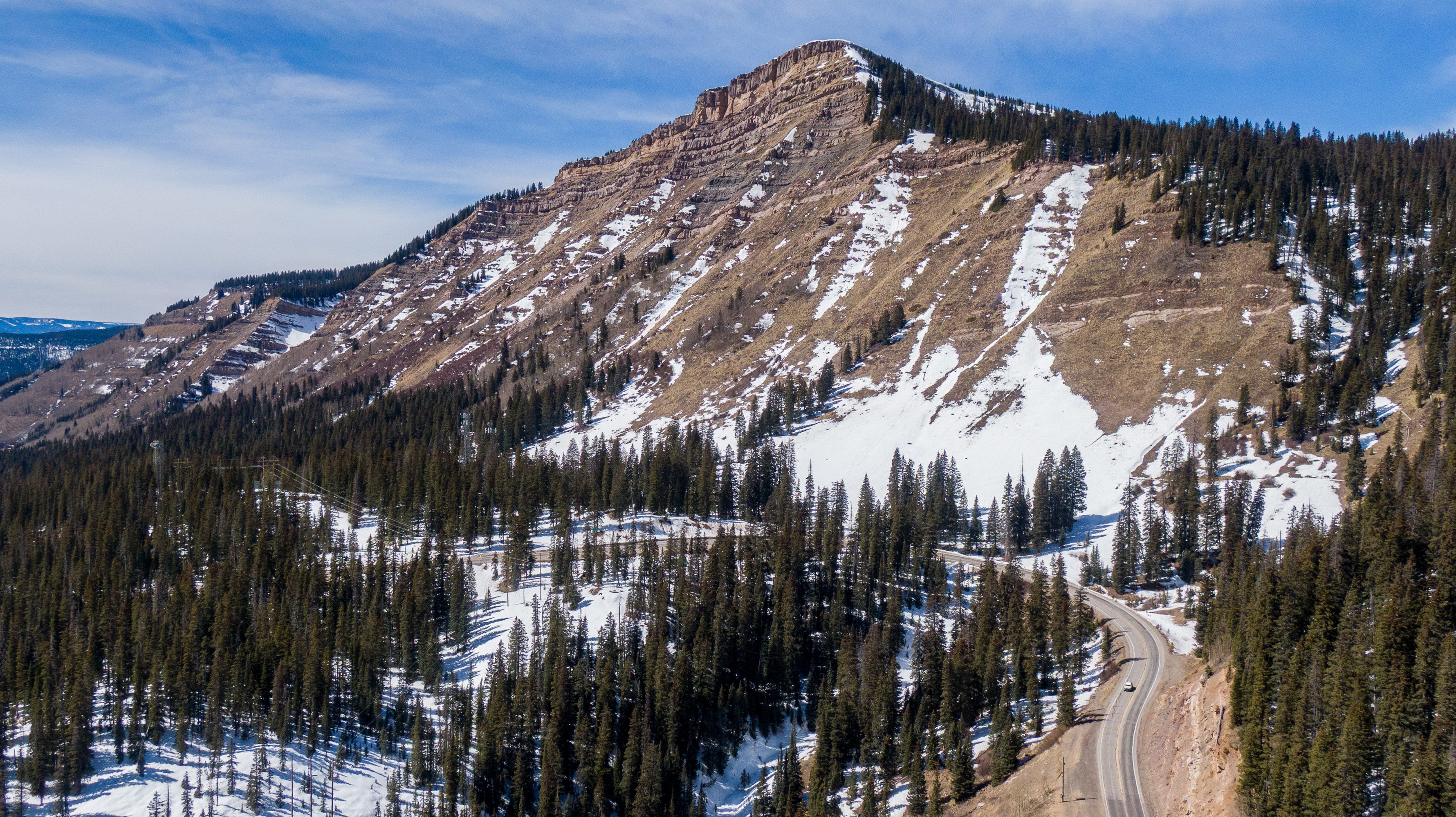
On Saturday, heading to ski at Crested Butte and Monarch, I drove over three mountain passes in the San Juans above 10,000 feet. I used my drone to capture the low-to-nonexistent snowpack.
Flying a few hundred feet above the ground—rather than in a jet—offers a more intimate perspective on the conditions below.
Sigh. Such a bummer for the beloved spring skiing season, and a terror for what’s to come. That projection of the dams is awesome/terrible to see. Would something like horsetooth reservoir here in fort colllins have an equivalent ?