Swiss-Colorado summit, headwaters aerials, and what I've been reading
Some cool images and snow-related stories for your summertime perusal

In the San Juan Mountains of southwest Colorado, there’s a sign on U.S. 550 that advertises the area around Ouray as the “Switzerland of America.”
I’m not sure if there are any “Colorado of Europe” signs in Switzerland, but I do know the European nation and American state are similarly blessed with sublime alpine scenery.
Switzerland and Colorado are also home to vibrant communities of snow scientists and mountain guides—two groups that have been documenting and coping with a changing cryosphere.
In early June, the Consulate General of Switzerland in San Francisco organized a series of events in and around Boulder to discuss how snow and ice are being transformed in both locations due to climate change. The eclectic group also included artists, diplomats, and policymakers.
An altered snowpack and accelerated melting pose threats not only to citizens of Switzerland and Colorado but also to vast populations beyond their borders who rely on snowmelt-driven rivers for their water supply and economic vitality.
Swiss glaciers lost 10% of their volume just in 2022 and 2023, a recent study found.
I was honored and excited to participate in the Swiss-Colorado summit, which afforded me the chance to meet diverse experts while enjoying a visit to the still-snowy Front Range mountains west of Boulder.
(Disclosure: I was paid an honorarium to moderate a panel and take part in an all-day excursion that included a tour of the Mountain Research Station, part of the University of Colorado Boulder, which is my employer and which paid for my travel expenses. This post and newsletter are my sole responsibility.)
Below, I share some highlights and photos from the excursion, which was led by Angela Hawse, an internationally licensed mountain guide and former president of the American Mountain Guides Association. The next day, at a conference at CU Boulder, Hawse showed stunning videos of rockfall caused by the melting of the permafrost that helps glue together the mountainside.
While mountain guides “live close to the edge” and are accustomed to dealing with risk, “up until recently, those were fairly easy to manage because we felt the mountains were fairly solid things,” Hawse said. “Sure, there’s rockfall, there’s icefall, there’s changing glaciers. But now we’re finding it increasingly difficult to anticipate the changes in our workplace.”
Hawse said that some classic routes “are no longer even viable to guide or climb because they’re so dangerous with rock- and icefall, or glaciers pulling apart from rock where there’s increased crevasse hazard that’s just unmanageable.” Moreover, “as these glaciers recede, it becomes increasingly difficult to get up to the start of some of the routes,” said Hawse, who described mountain guides as “barometers of change.”
“We spend a tremendous amount of time in the same places year after year,” Hawse said. “I’ve guided for 35 years all over the world—22 countries from the Antarctic to the Arctic. I’ve seen a lot of change, and our story isn’t that well known.”
Alex Hager of KUNC wrote about the meeting: “The Alps meet the Rockies at this summit on snowmelt.”
Touring the Mountain Research Station
The Mountain Research Station, which has operated at its current location in the mountains west of Boulder since 1920, is one of the world’s oldest alpine research sites. It’s now part of the Institute of Arctic and Alpine Research, which was created in 1951.
The station is known for collecting long-term, high-elevation data that has informed a variety of research. On nearby Niwot Ridge, scientists have gathered readings on rising levels of carbon dioxide since 1967—the third-longest record on the planet. During our visit, we also saw weather instruments that can warn of imminent flooding downstream in the Boulder area.

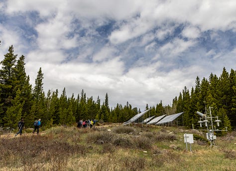


As part of our tour, we visited a fascinating research project where scientists are using a motorized tram to gather precise data across a 400-foot transect to better understand the forest ecosystem. The sensors, which collect data on water, energy, and vegetation, take one hour to make the round-trip journey through the woods.
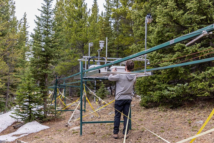

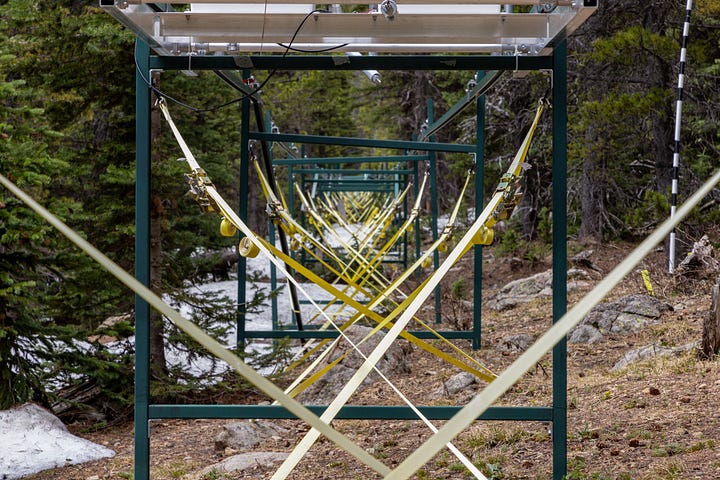
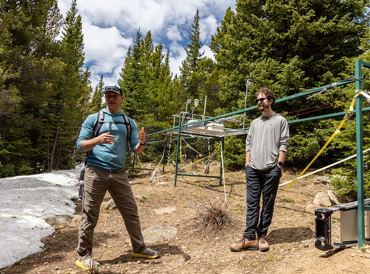
“The idea is to study this continuum of the landscape,” CU Boulder scientist Keith Musselman explained. “We’re interested in how water—in the snow, in the soils, and as it’s used by the trees—varies over distances.”
The platform of sensors also measures weather conditions and the health of the local vegetation as it monitors incoming solar radiation and the energy released by the forest.
“We have sensors looking up and sensors looking down to understand what’s coming in and what’s going out, and that gives us our net energy balance,” Musselman said.
The tram, which cost about $180,000, was inspired by a similar device in Davos, Switzerland. It’s part of the Front Range Ecosystem Resilience Project, a $3.6 million interdisciplinary effort funded by the National Science Foundation that focuses on the climate-change refugia that are best suited to weather global warming.
Brainard Lake journaling
We then hiked a couple of miles to Brainard Lake, a gorgeous spot with commanding views of the Continental Divide. Compared to my home in southwest Colorado, there was a lot more snow thanks to May storms that bypassed us. I felt a little jealous.
At the lake, we all did a journaling exercise in response to two questions: How does this place make you feel? How does it connect to your profession?


It was intriguing to hear both the common themes and different perspectives in a group that included artists, diplomats, mountain guides, a scientist, and a journalist (me). When it came time to add my two cents, I mumbled through some musings, which I’d retrospectively clarify into:
My utter insignificance: These alpine landscapes always make me feel so tiny and inconsequential, dwarfed by the weather, topography, and geologic history. Yet I find that dose of humility to be strangely liberating and a refreshing reminder not to take myself or anything else too seriously. Ditto for staring up at the Milky Way or down into a desert canyon, but for me, snow-capped mountains are extra special and like the icing on the cake. I think the thrill is partly rooted in fear: the exposure, the avalanche danger, the rocks precariously balanced at their angle of repose (at least for now).
Embracing complexity: We could see everything from bare rocks to deep pockets of snow that begged to be skied (especially if the legendary guides in attendance could lead the way!). Likewise, I was simultaneously fascinated and overwhelmed by the convoluted backstory to the postcard scene: the eons of geology, the fraught human history, the real-time hydrology, the rapidly changing ecology, the convoluted land management. As a journalist and generalist, I’ve always struggled to understand and communicate that deep complexity in a way that’s simple enough to engage a lay audience but also true to reality and science.
Words versus visuals: I started my journalism career as a writer, but I’ve migrated toward photo/video because I find my prose is totally inadequate for capturing places like this—and for getting others to care about what’s at stake. So much nature writing can be overwrought, like those dreadful AI-generated landscape images now flooding social media (e.g., Facebook’s “Feel the Nature”). This place’s authenticity seemed like the opposite of AI and demanded verisimilitude.
Gratitude and awe: I feel so lucky to live in Colorado and to be amidst such captivating landscapes. For more on the health benefits of awe and time in nature, see this story by journalist Florence Williams, and check out her great book, The Nature Fix: Why Nature Makes Us Happier, Healthier, and More Creative.
Aerial tour of headwaters
In late May, I was fortunate to take a breathtaking aerial tour of the Rio Grande’s headwaters in the San Juans. We then followed the river down to its gorge-ous path through the Rio Grande Rift, near Taos, New Mexico. I’m grateful to volunteer pilot Barry Harper and LightHawk for the pro bono flight.
One of my goals was to capture imagery of the snowpack and high-country lakes/reservoirs in southwest Colorado for the free multimedia library we offer at The Water Desk.
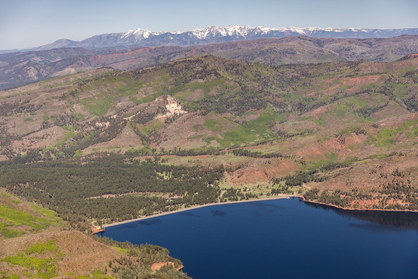
To get to the Rio Grande headwaters from Durango, we first flew over the Colorado River Basin. Below is a shot of Vallecito Reservoir, built between 1938 and 1942 to corral snowmelt and other runoff for flood control and irrigation (more Vallecito photos here).
We also passed by Emerald Lake in the San Juan National Forest’s Weminuche Wilderness. Our family backpacked around there last summer, and in the photo below, you can really see how past glaciation carved a classic U-shaped valley leading up to the lake.
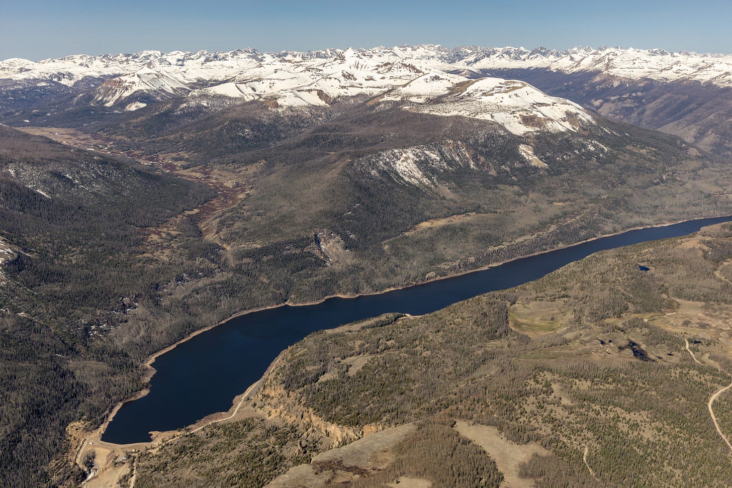
We then reached the Rio Grande’s source, located in a remote part of southwest Colorado. The photo below shows Rio Grande Reservoir, which was created more than a century ago to store irrigation water for the San Luis Valley downstream.
As I noted in an earlier post, this season’s snowpack melted out very quickly in southern Colorado, and I was struck by how little snow was left in late May after a roughly average season. The photo below shows the Rio Grande snaking its way toward the San Luis Valley with the snow gone from all but the highest elevations (more Rio Grande headwaters photos here).
What I’ve been reading
It’s not exactly beach material, but here are some snow-related stories I’ve been reading this summer:
The U.S. Drought Monitor is a critical tool for the arid West. Can it keep up with climate change? Hayley Smith, Los Angeles Times, 6/3/24
Robots could clear snow, assist at crosswalks, monitor sidewalks for traffic. Carnegie Mellon University, 6/5/24
Modeling ice and snow on planets. Shelly Sommer, Institute of Arctic and Alpine Research, 5/16/24
Frosty volcanoes discovered in Mars’s tropics. The European Space Agency, 6/10/24
Scientists aim to improve Western snowfall, water supply forecasts with research project in Colorado. Kaleb Roedel, KUNR, 5/16/24
Groundwater in the Colorado River Basin will struggle to recover from warming temperatures, study shows. Shannon Mullane, The Colorado Sun, 6/24/24
Satellites find that snow didn't offset southwestern US groundwater loss. James R. Riordon, NASA, 6/17/24
Mystery of the Disappearing Snowpack. Allen Best, Big Pivots, 5/14/24




Always enlightening and fascinating, Mitch!