Rain-snow transition blues
Plus the latest snow.news and an update on the snowpack

Last week, Colorado’s high country was blanketed by heavy snow, delivering a nice boost to the mountain snowpack and the start of the ski season.
But at lower elevations, including my home base at 7,600 feet, the relatively warm atmospheric river moving inland produced rain and a sloppy wintry mix, which I always find so disappointing compared to snowflakes.
Growing up on Long Island, I remember my bitter disappointment when highly anticipated storms that were expected to create cherished “snow days” actually turned into sullen bus rides to school in the rain. The weather gods had delivered a math test rather than sledding and snowball fights.
Around the world, the dividing line between rain and snow is on the move, and it’s something that scientists are keenly interested in given global warming trends.
The rain-snow transition is the subject of several studies I’ve summarized in an annotated bibliography of snow-related climate change research that I recently pulled together for The Water Desk.
One of those studies, published in 2014, has a powerful but sobering visual related to the issue, which I’ve included below. The left column of maps shows the past climate (1979-2012) by month, and the right column shows the future climate (2035-2065). Blue areas are rain-dominated, white areas are snow-dominated, and the pinks/reds show mixed areas.
This very narrow but eye-opening graphic gives you the skinny on the study’s results: there’s a shift from snow to mixed and rain-dominated systems, especially at the beginning and end of the season.
“At broad scales, these projections indicate an average 30% decrease in areal extent of winter wet-day temperatures conducive to snowfall over the western United States,” according to the study. In the future, “many mountainous areas will be characterized by a mixed rain-snow regime in November, in contrast to the historic strongly snow-dominated precipitation regime.”
The late November storm made for a fun powder day at Purgatory, and I consider any skiing before Thanksgiving a bonus before the real season begins. But I was bummed the temperature was just a few degrees too warm for it to snow at home. I was actually hoping to break out the shovel, and maybe even crank up the snow blower. It certainly would have been more fun and better exercise than watching rain drip off the roof.
snow.news roundup
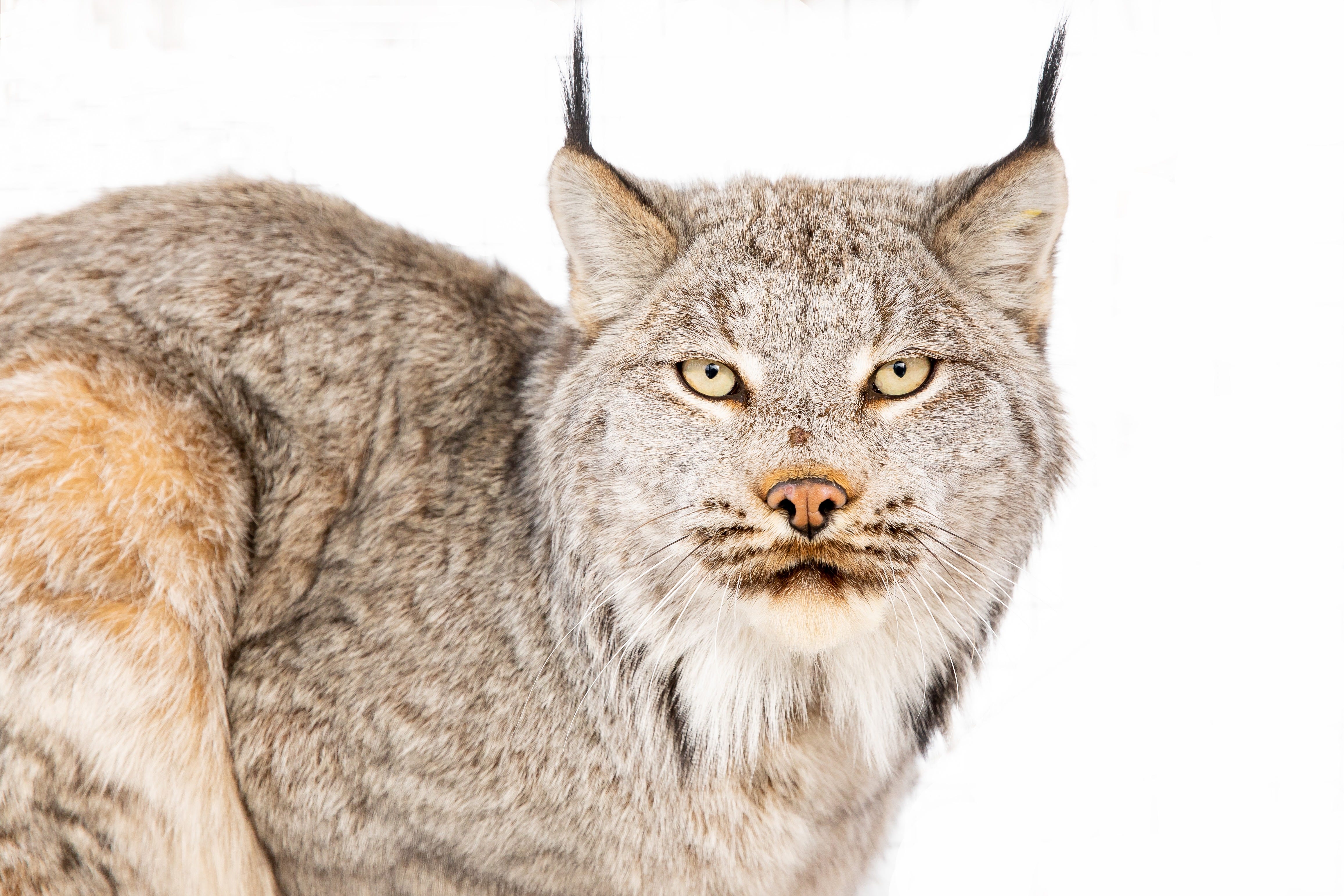
Canada lynx proposed for new habitat protections in US southern Rockies. Matthew Brown, Associated Press, 11/27/2024
This endangered cat and its main prey species, the snowshoe hare, rely on the snowpack, so they’re threatened by climate change. Environmentalists cheered the finalization of the recovery plan and the addition of new critical habitat to Colorado and northern New Mexico. “That’s different from a previous plan that left out the southern Rockies and concentrated instead on recovery efforts elsewhere, including Wyoming, Montana, Minnesota and Maine,” Brown writes. “The fate of the proposal is uncertain under President-elect Donald Trump: Officials during the Republican’s first term sought unsuccessfully to strip lynx of protections that they’ve had since 2000 under the Endangered Species Act.”
Why future droughts will not be about rain. Joshua Partlow, The Washington Post, 11/6/24
Climate change identified as main driver of worsening drought in the Western United States. Ian James, The Los Angeles Times, 11/7/24
A new study in Science Advances finds that rising temperatures since 2000, rather than changing precipitation patterns, have been the key factor behind the West’s long-term drought. Warmer weather means more evaporation. For the West’s epic dry spell from 2020 to 2022, the researchers calculated that 61% of the drought’s severity was due to higher temperatures and 39% was due to a precipitation deficit. Co-author Rong Fun, a UCLA professor, told Partlow that “this is quite different from our grandma’s drought.” According to James’ story, “scientists say the severity of future droughts will be determined largely by how much more planet-heating gases humans release into the atmosphere.”
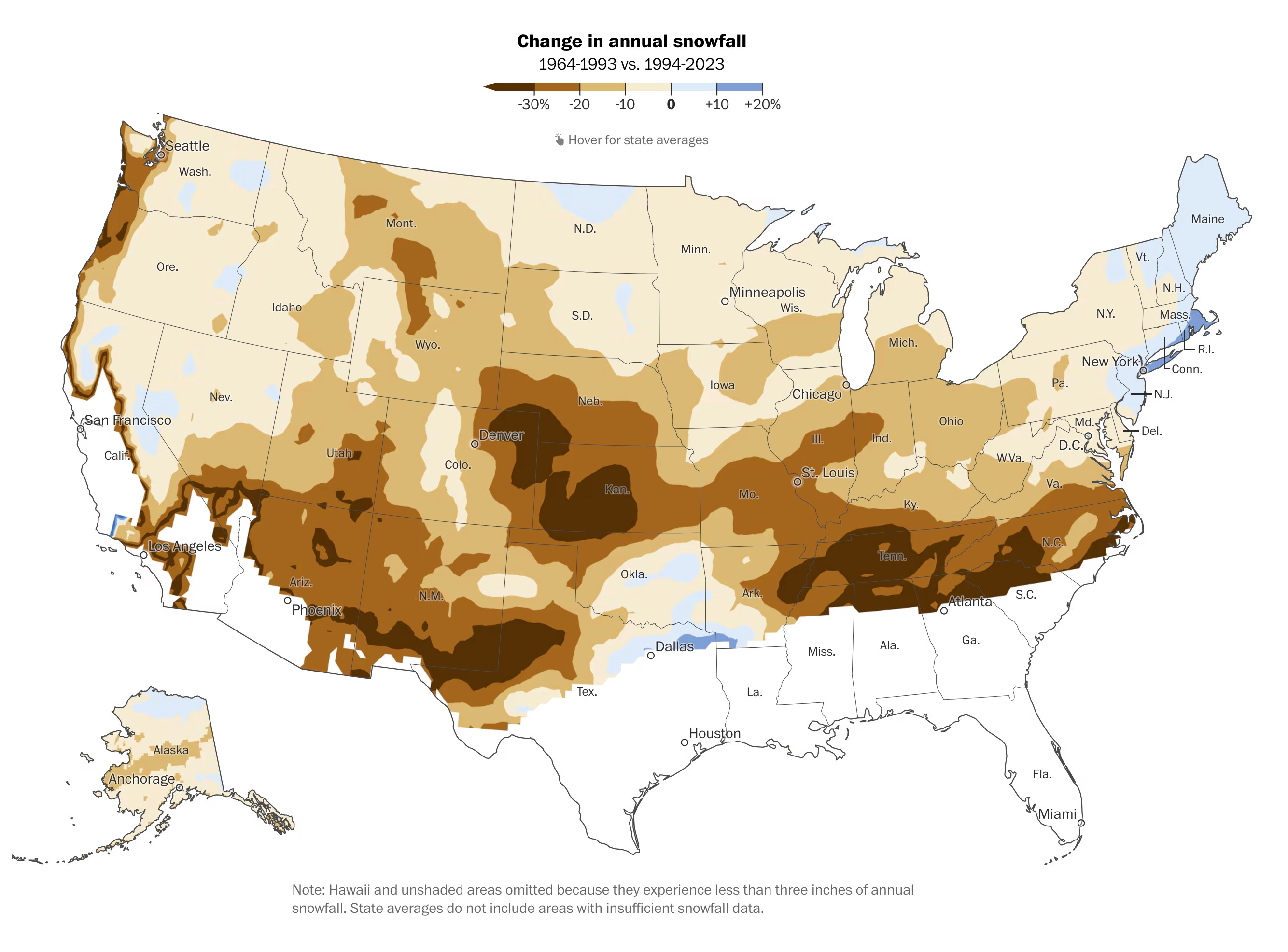
Dreaming of snow this winter? Look up the forecast in your area. Harry Stevens and Ben Noll, The Washington Post, 11/13/2024
The Washington Post didn’t weigh in with a presidential endorsement, but the paper has made a bold prediction for U.S. snowfall in the coming winter. Its forecast is “a blend of seasonal climate models from the United States, Britain, France, Germany, Italy, Japan and Canada — a ‘wisdom of the crowds’ technique that yields more accurate seasonal forecasts.” I hope this forecast bombs because the epicenter for the snow drought is centered close to home, but it’s still an interesting analysis that also includes a comparison of annual snowfall in two periods: 1964-1993 and 1994-2023.

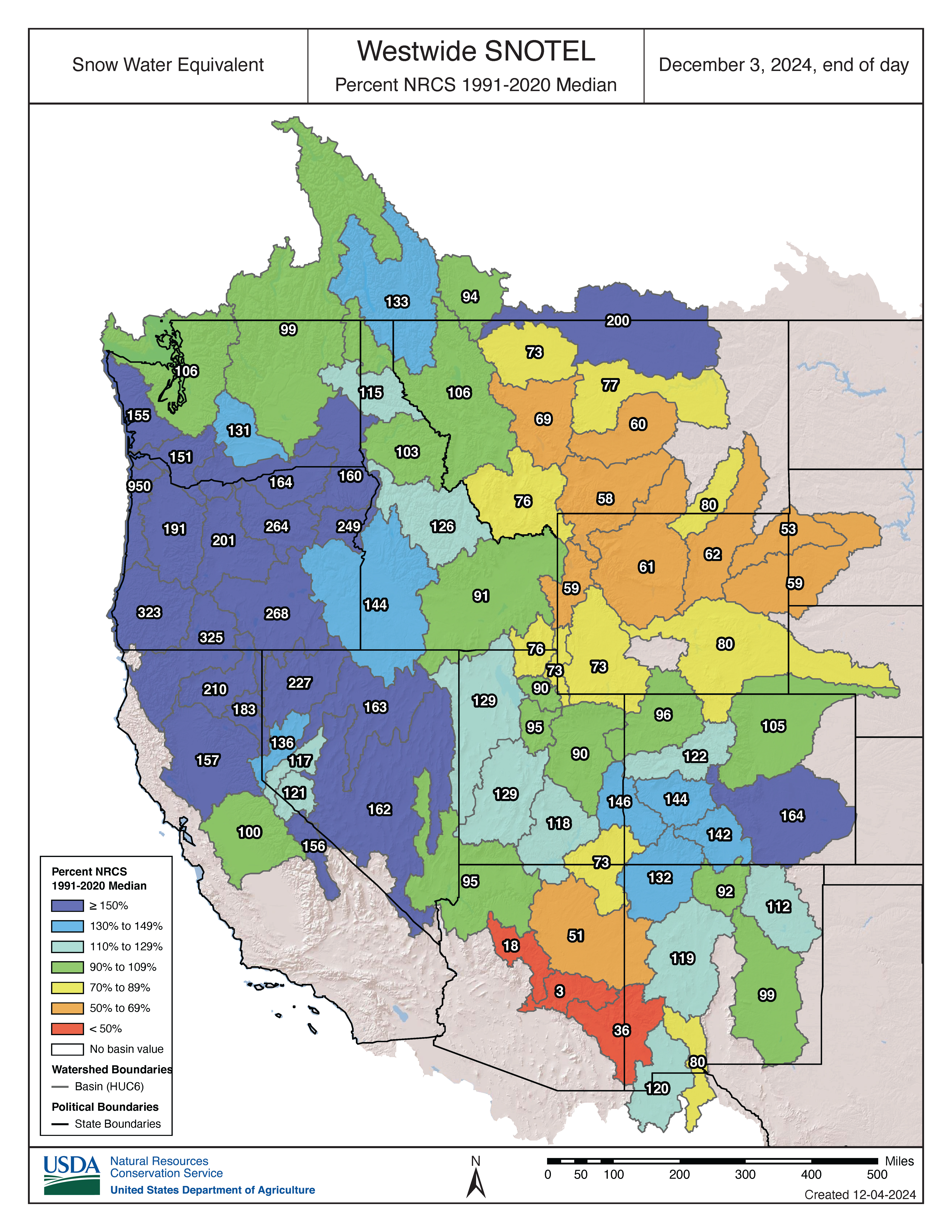
Snowpack update
We’re now in a dry stretch, but it has been a solid start for the snowpack in much of the West. The December 3 map below shows that conditions are above normal in many places, and especially near the Pacific Coast due to some potent atmospheric rivers. But the snowpack isn’t doing so well in Wyoming, Arizona, and part of Montana.
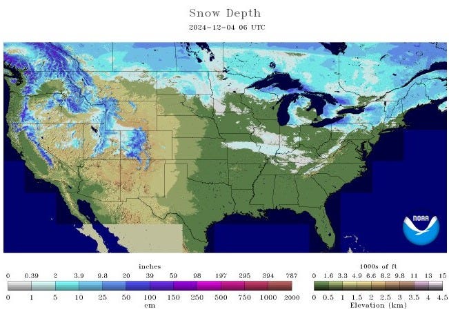
If you’re curious about where there’s snow on the ground, check out these maps from NOAA’s National Operational Hydrologic Remote Sensing Center. The graphic below shows snow depth across the lower 48 states and reveals deep conditions around the periphery of the Great Lakes thanks to recent “lake effect” storms that have dumped several feet of snow.
Purgatory panorama-rama
Below are some very wide-angle views of the San Juan Mountains, seen from the slopes of Purgatory ski area after a healthy 12” storm before Thanksgiving.