A few months ago, southwest Colorado was gripped by severe drought following the worst winter snowpack in generations, a record-breaking spring heat wave, and a lackluster summer monsoon.
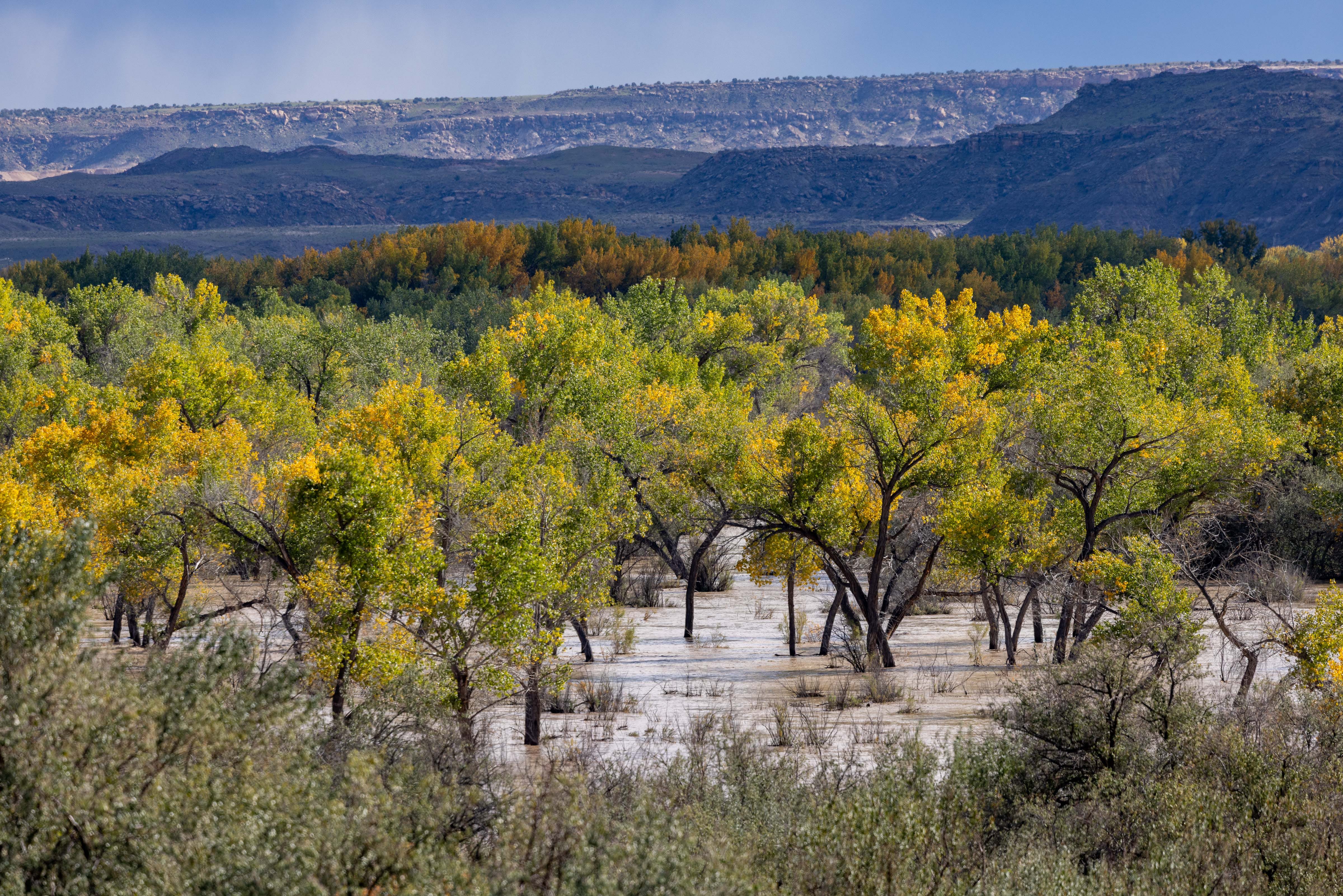
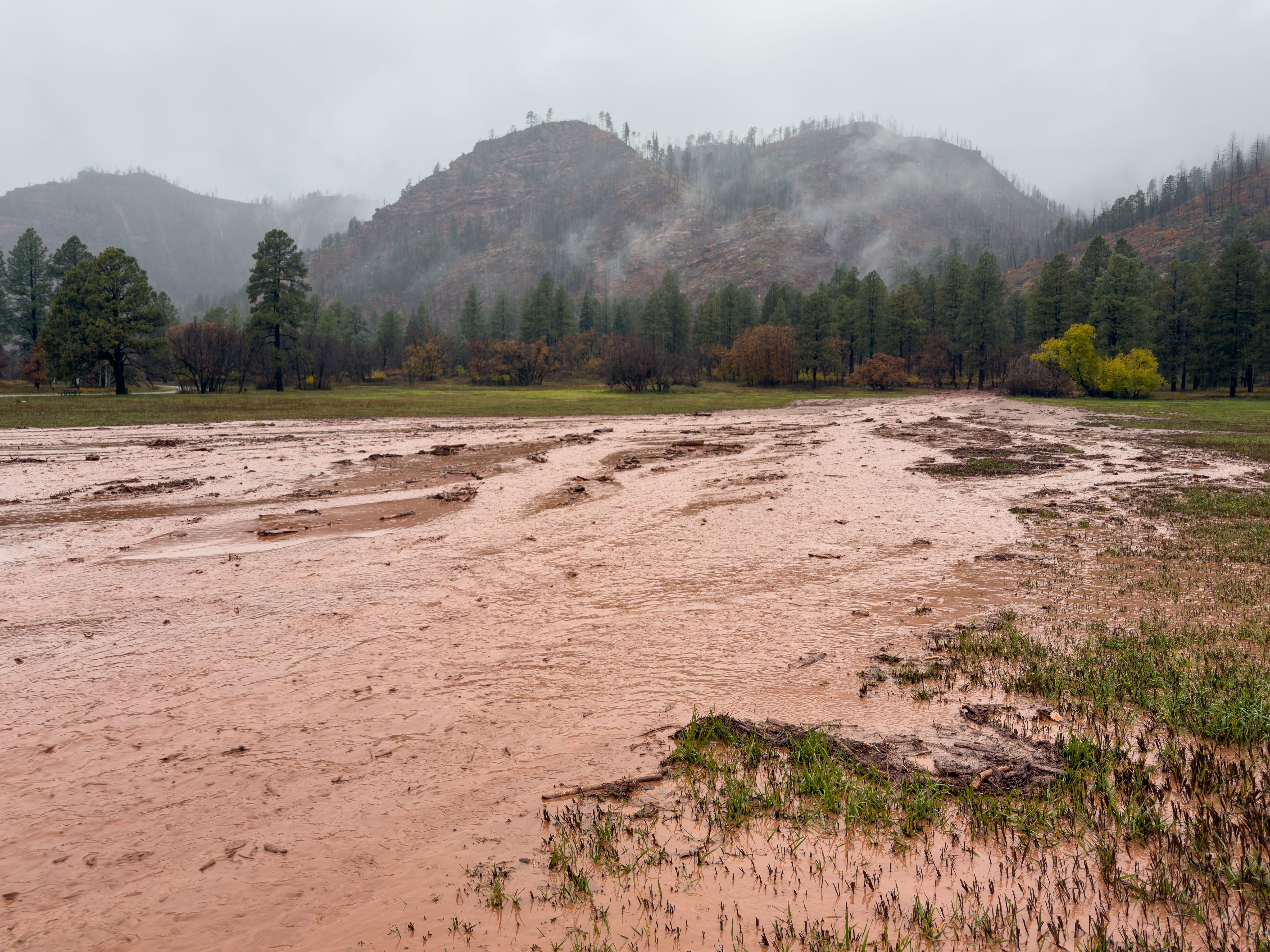
Now, the region is experiencing historic flooding after extraordinary rainfall this fall.
For the second time in recent weeks, communities in the Four Corners have been inundated, causing numerous evacuations and road closures. The damage toll from the latest flooding is still unclear.
If only more of this precipitation had fallen as snowflakes.
Video: flooding in my neighborhood north of Durango on November 1
I planned to spend this morning photographing the flooding, as I did last Sunday, but I was stuck at home because the La Plata County Sheriff temporarily closed all county roads due to high water and debris flows.
That closure was just lifted, but I can’t even get out of my neighborhood because water, mud, and debris have washed over the road in several places. I was stunned to see huge boulders and tree trunks transported by the runoff—the power of water never ceases to amaze me.


We live in a semi-arid region, on the edge of the high deserts of the Colorado Plateau, so 0.10” of rain is usually cause for celebration. But yesterday, my rain gauge recorded a remarkable 3.70” at my house north of Durango, after an incredible 8.02” in September and 8.86” in October. I don’t know what the normal rainfall is here at home—or even what normal is anymore—but Durango averages close to 20” of total precipitation per year.
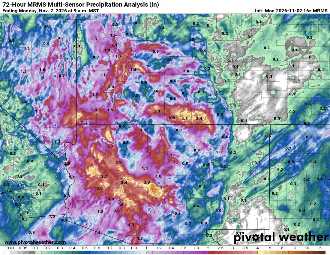
The map below shows an estimate of precipitation over the past 72 hours in the Four Corners region, with some areas exceeding four inches.
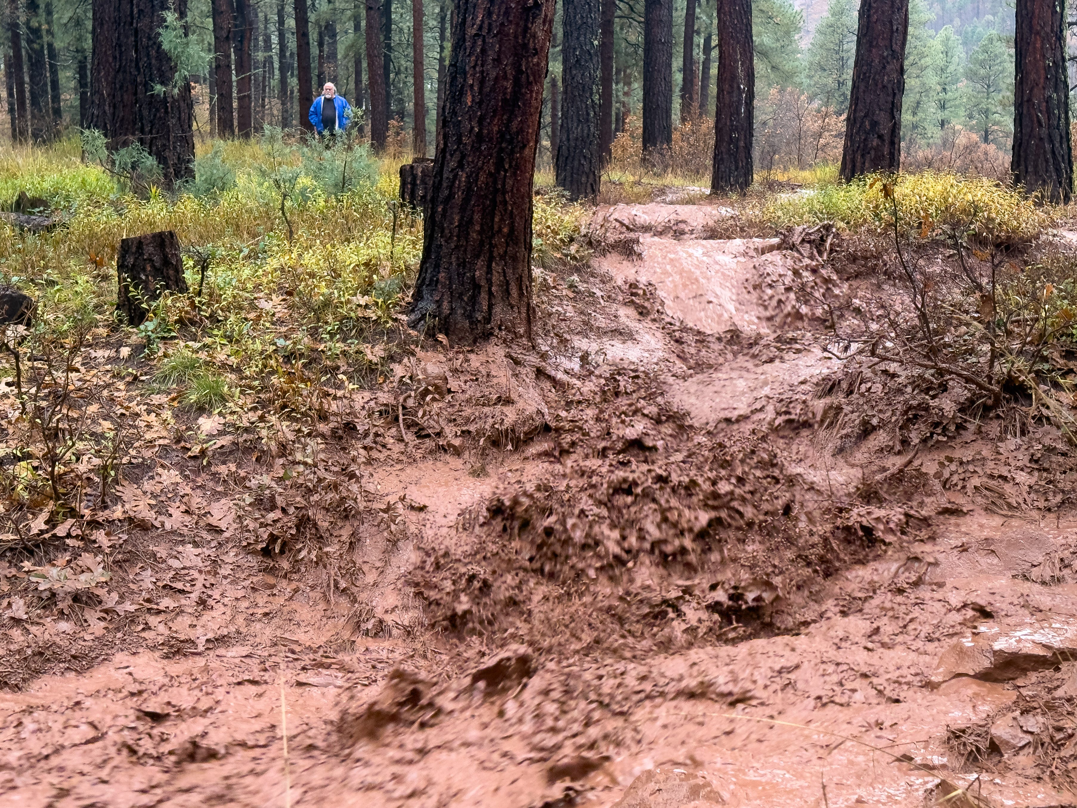
Thankfully, our family is safe, but this storm has been eye-opening and has transformed my understanding of the local landscape and hydrology. Normally dry gullies turned into raging torrents. A nearby meadow became a swamp where I sank up to my ankles in liquefied soil. Last night, I repeatedly heard boulders thundering down cliffs scorched by the massive 416 Fire in 2018.
Over the past two months, we’ve been hit by a series of warm storms with copious tropical moisture, including the remnants of a hurricane and an atmospheric river. There’s been some snowfall at the highest elevations in the San Juans, but the snow line has been relatively high. If more of this precipitation had been snow and remained stored in the snowpack’s frozen reservoir, I don’t think the flooding would have been as severe.
National Weather Service Meteorologist Briana Bealo told the Durango Herald that forecasters had expected the transition from rain to snow would be at lower elevations during this weekend’s storm:
“We originally thought we were going to be getting snow down to 9,000 or 10,000 feet, and a lot of that higher-elevation moisture was going to be snow and not runoff,” Bealo said. “Now, we’re seeing liquid precipitation up that high, and all of that’s becoming runoff and flowing into the rivers.”
I don’t have the data, but I suspect the rainstorms also exacerbated runoff by melting some of the existing snowpack. Rain-on-snow events are a well-known cause of extreme flooding, and in the days leading up to yesterday’s deluge, the National Weather Service office in Grand Junction mentioned that possibility in its forecast discussion. On Bluesky, Colorado State Climatologist Russ Schumacher wrote on October 31:
I do not envy the forecasters for this flood….small changes in temperature could alter elevation of the rain/snow line, risks for rain on snow, etc., which could all mean big shifts for better or worse in the flooding.
Looking ahead, I’m interested to hear what scientists and weather experts learn about the forces behind this flooding. What was the influence of the powerful El Niño we’re experiencing? Did climate change make the disaster more likely?
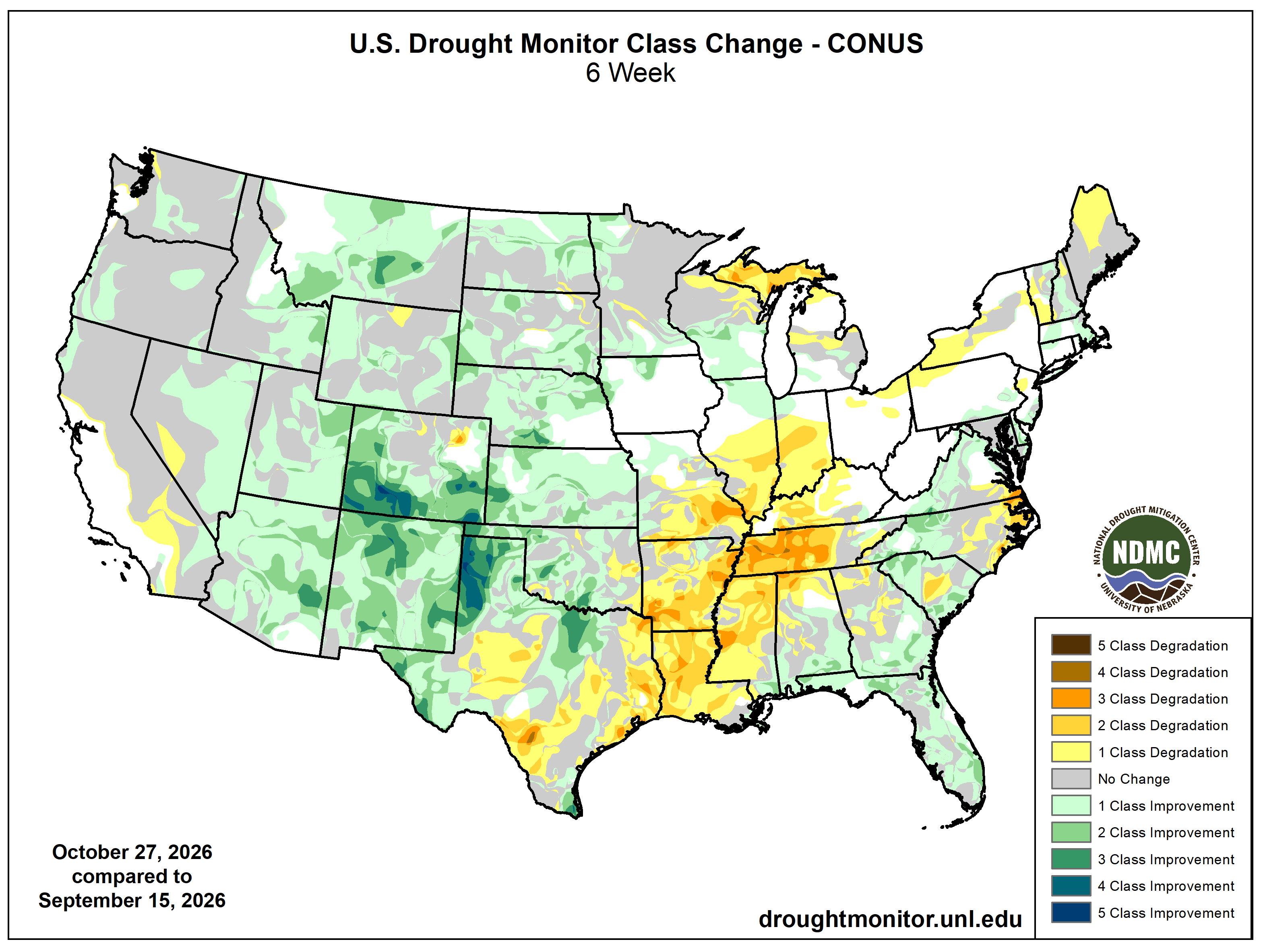
The silver lining to the Southwest's recent heavy rainfall is that it bolstered the region’s water supply. The U.S. Drought Monitor map below shows that in the six weeks leading up to the most recent update, on October 27, many areas in the Four Corners states saw major improvements in drought conditions, including the total elimination of drought across much of southwest Colorado.
Although this exceptionally wet period has been a drought buster, it’s certainly come at a steep cost. In my travels on October 25, I saw floodplains with cottonwood forests where the inundation may have been ecologically beneficial. But in Shiprock, New Mexico, it was heartbreaking to see mobile home parks swamped by the San Juan River.
For so long, we’ve been worried about too little water. Now the region is dealing with the devastation wrought by too much, too fast.